
Searching Gilmer County Property Records
In Gilmer County, property records sit across connected systems rather than one complete file. The Assessor ties an owner name and situs address to a tax parcel. The Clerk records deeds, deeds of trust, liens, plats, and releases. The Sheriff/Treasurer handles tax tickets and balances. The WV Property Viewer puts an IAS parcel on a GIS map. It also links to the assessment report. Pick the source that fits your question first. Then carry the parcel number, or the deed book and page, into the next property search.
For an address lookup, try the Assessor's Street Name search. Or use the state viewer's E-911 address mode. For a known owner, search the roll and then the Clerk index. For an older chain, follow the grantee back as a grantor. Keep the legal description beside the modern parcel ID. Road names and postal labels change. The land record stays tied to its legal description.
- Search the state assessment portal by Street Name, Owner Name, or parcel parts and note the full IAS number.
- Open the parcel in WV Property Viewer and compare the physical address and legal description.
- Use the owner or parcel as a key in the Gilmer County Clerk document index.
- Check the Web Tax Inquiry for the year, ticket, map-parcel, billing address, and balance.
- Request office or archival copies when an online result is incomplete.
Gilmer County Property Record Offices
Gilmer County splits this work among custodians. The Clerk records instruments and handles probate. The Assessor keeps the owner roll and appraisal data. The Sheriff/Treasurer collects taxes and preserves ticket history, while state-hosted assessment and parcel tools display county data and the State Archives and WVU preserve older plat books and finding aids.
Gilmer County Assessor
County government offices
Glenville, WV
Use the linked office page
What Gilmer County Property Records Include
The record type matters as much as the search result. A deed transfers an interest. A deed of trust secures an obligation. A plat shows a recorded layout. An assessment describes the tax parcel and its value. A tax ticket shows the tax year and payment state. One parcel may hold several of these records. Each sits in a different office.
| Record Type | What It Documents | Kept By | Access |
|---|---|---|---|
| Deeds and releases | Transfers, easements, liens, releases, and book/page references | County Clerk IDX | Free search; copy fees not stated |
| Assessment roll | Owner of record on July 1, situs, mailing, appraisal, and sale fields | Assessor / WV portal | Free online; map-card copies at office |
| Tax tickets | Year, ticket, billed and paid amounts, due balance, and billing address | Sheriff/Treasurer | Free view and print; payment fee applies |
| Parcel and plat records | Parcel polygon, map ID, plat, lot, road, and legal-description clues | WV Viewer / County Clerk | Free viewer; copy rules vary |
| Probate and court files | Wills, fiduciary authority, lis pendens, foreclosure, or judgment context | Clerk / court clerks | Index or office request |
A title question calls for the deed and any later releases, not just the tax roll. A tax question starts with the assessment and the ticket. A boundary question needs a survey. A GIS map helps locate the tract. It is not a survey. The Gilmer County deed records page explains the Clerk's instrument trail, while tax amounts belong with the County's tax inquiry and office.
Limits of Gilmer County Property Records
Gilmer County records show facts filed or assessed by a custodian. They do not prove every interest was recorded. A tax-roll name may lag a sale made after July 1. A GIS line is not a surveyed boundary. A tax assessment follows a statutory valuation method. So it is not a current sale appraisal. Confirm any result with the office that keeps it. Get professional title or survey work when the decision turns on legal priority or a boundary line.
Lawful use. Use Gilmer County property records for a property matter, civic research, or house history. Public access does not permit stalking, harassment, threats, or unwanted contact with an owner.
The Gilmer County Clerk Index
The County Clerk's Online Document Search sorts Gilmer County records by index, sub-index, type, and book. Search roles include Grantor, Grantee, Creditor, Debtor, Deceased, Personal Representative, Groom, and Bride. Each row shows date, document, book/page, page count, name, cross-date, and instrument fields. A row is only an index reference. The index lists no image fee. It also lists no earliest year.
Beyond deeds, the type list runs deep. It includes Deed of Trust, Easement, Right of Way, Plat, Plat in Deed Book, Mechanics Lien, tax liens, HOA Lien, Lis Pendens, Trustee Sale, Tax Deed, Cemetery Deed, oil and gas lease, Affidavit of Heirs, and transfer-on-death beneficiary affidavit. Search a term that describes the interest. Then check for a release or later deed. The county's home page groups document search with tax, GIS, and map-card links, and an official service page shows those entry points together.
Street Names in the Assessment Roll
The WV Real Estate Assessment search accepts county, district, full parcel ID, owner name, map number, property class, street name, tax class, sub-parcel, and land use. Its Appraisal/Sales mode adds value and acreage ranges plus sale date and price. Advanced search adds mailing address, flood hazard, deed book, page, legal description, building year, building area, and structure counts. Dropdown options can change. Use the portal's live controls rather than a fixed list.
Street Name helps where a rural address is incomplete or several parcels line one road. The WV-5 street-search example shows that mode. Results can add legal description or GIS parcel ID columns. They can also open the parcel viewer. Search is free, but map-card copies come from the Assessor's office.
From E-911 Address to Parcel
The WV Property Viewer pairs two state systems. Physical E-911 searches draw on the Statewide Addressing and Mapping System. Owner and parcel lookups come from the Integrated Assessment System. Rural routes and P.O. boxes will not work as search keys. When an address fails, try the street name, the owner, or a parcel ID instead. The parcel number combines district, map, parcel, suffix, and special-ID segments. Keep any leading zeroes intact.
A detailed record in the viewer can include the description, property owner, physical address, building information, cost and appraised values, E-911 address, delinquent status, and community. It may also include flood information. One caution applies. A list card may show only a single owner even when co-owners exist. The viewer also offers identify, highlight, copy link, KMZ download, and CSV export. The map links location to record keys well, but it cannot settle a boundary.
The parcel viewer screen places its address, parcel, and flood controls beside the detail panel.
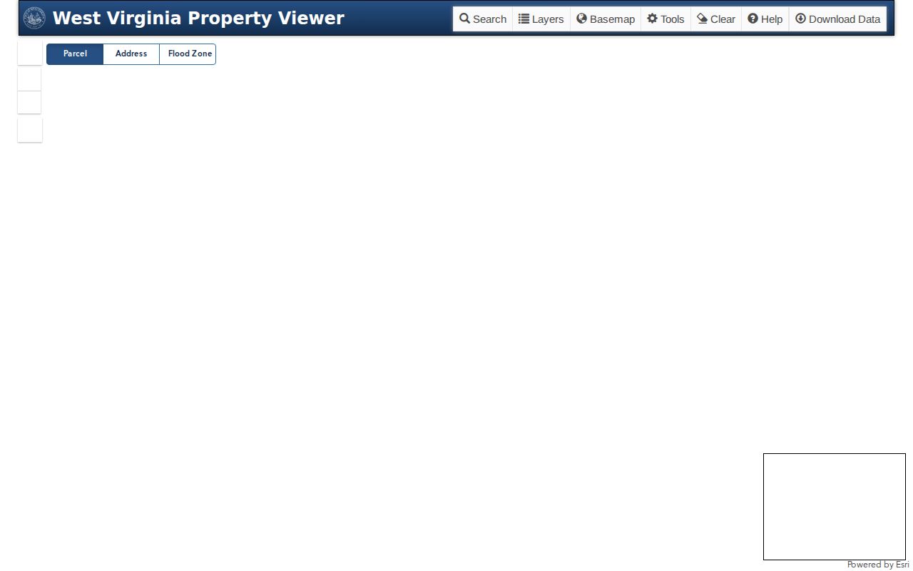
Treat the polygon you see as a tax mapping reference only. The Clerk's recorded plat or a licensed survey is the real boundary evidence. The Gilmer County website keeps the Clerk index, tax inquiry, and parcel services together with other official county resources.
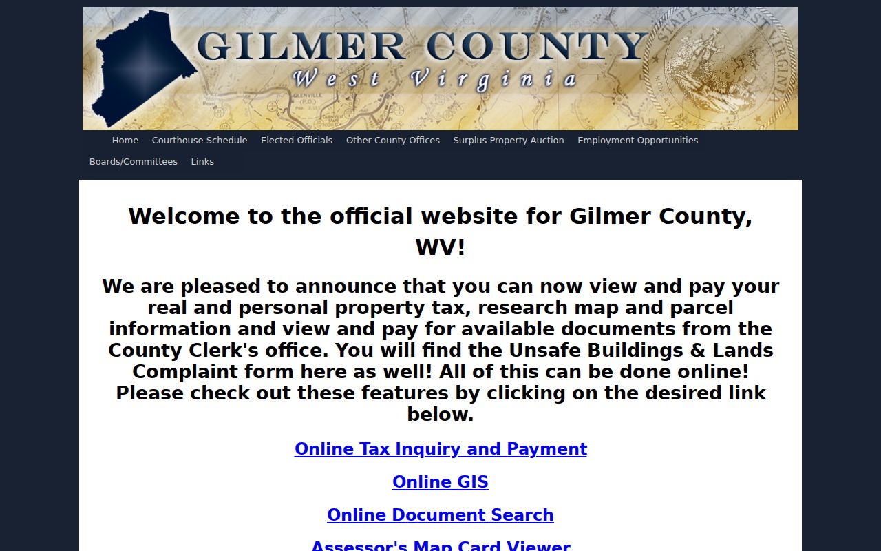
Start with the county page to spot the local custodians. Then lean on the statewide tools for assessment and GIS searches.
Gilmer County Tax Tickets
The Web Tax Inquiry splits account details from ticket details. Columns shown cover year, type, ticket, name, total paid, and total billed. The rest include both half amounts, total due, account number, map-parcel, description, and billing address. That mix of fields helps you reconcile the parcel ID with the tax bill. It matters when the mailing name or postal address differs from where the land actually sits.
Gilmer County lets a visitor view and print a ticket for free. Paying online adds a Certified Payments fee. Check the site for the amount owed and the payment state. Then ask the Sheriff/Treasurer about current delinquent-land steps. The county publishes no current sale calendar, redemption deadline, or bidder deposit schedule. The county tax inquiry lays out its search and ticket fields.
The official Gilmer County tax inquiry displays account, map-parcel, and billing data side by side.
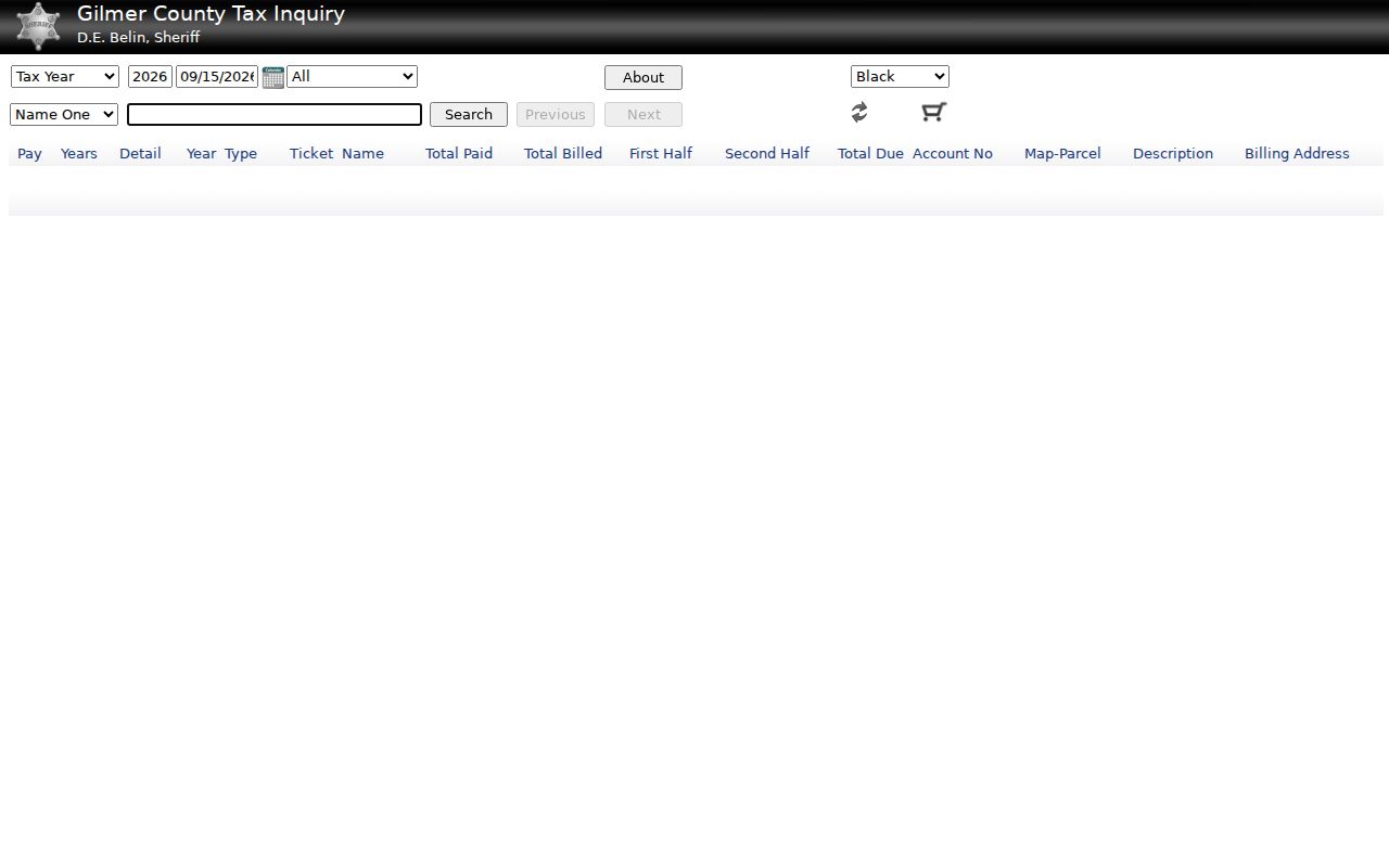
Carry the map-parcel field back into assessment and GIS records. One land key, several offices.
Why July 1 Sets the Owner Roll
West Virginia assesses property on July 1 each year. It uses 60 percent of true and actual value. The name on the Gilmer County tax roll is the owner of record on that date. A deed recorded in August may not match the roll until the next cycle. So a newer deed is not an error. The county publishes no average update lag. The assessment display alone will not tell you when a transfer was recorded. Read the deed records for that.
State law requires a physical review every three years, with annual adjustments in between. If a qualifying assessment rises, notice goes out by January 15. Valuation appeals to the Office of Tax Appeals must be filed by March 31. Keep the notice, comparable sales, and parcel data in one file. Those deadlines govern the appraisal side. The tax-ticket display answers a narrower question. It shows whether the tax bill was paid or still due.
Historic Gilmer County Deed Books
The WV State Archives inventory covers Gilmer deed books from 1845 to 1902. It also holds a deed index running from 1845 to 1969. Trust deeds from 1894 to 1903 appear there. Delinquent tax sales from 1848 to 1872 appear there too. Releases, wills, inventories, and court books are included as well. The modern Clerk IDX publishes no start date for its online deeds. Do not mistake the archival span for web coverage.
For a chain of title, start with the latest known grantee. Record each book and page. Then search that same party as grantee in the prior conveyance. Work backward one deed at a time. Older material may sit with the Clerk or with the State Archives and WVU finding aids. Their copy rules differ. The State Archives inventory identifies Gilmer's historic microfilm holdings. The Gilmer microfilm finding aid lists the deed books, indexes, and related series in detail.
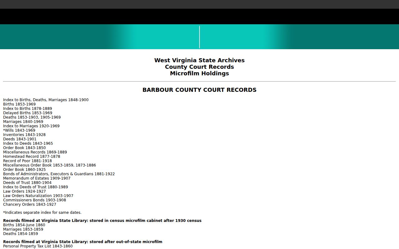
Use the listed years to decide when your chain must shift from online search to archival research.
The 1888 Courthouse Fire
An 1888 courthouse fire appears in the Archives finding aid beside its Gilmer inventory. Treat it as a practical warning. A chain that seems to skip a transfer may reflect lost records. It may not mean a missing deed. A blank search proves nothing. A gap in one book may call for a later deed that recites prior owners. Or it may call for a different archival series altogether.
Work the deed index, releases, fiduciary records, wills, and later legal descriptions. WVU's Regional History Center holds county-office reels. These include early order books plus birth, death, and will materials. Name searches alone can miss variant spellings. The parcel description and neighboring road or stream calls help pin down which tract is yours. Use them alongside the name work.
Leases, Easements, and Cemeteries
Gilmer County's land index covers more than house sales. Oil and gas leases, rights of way, road-book easements, cemetery deeds, plats, releases, and HOA liens may explain how a rural tract is used or reached. Each type does different work. A deed transfers an interest, an easement sets a use right, and a release clears an earlier claim. Match the instrument to the question you are asking.
The county land-record guide walks through this range of instruments. The Clerk's IDX lists several as searchable categories. Building search terms takes practice. The Gilmer land-record reference can help with that. A mineral or business filing may also appear in the Secretary of State's UCC system. Ordinary mortgages and land liens stay with the County Clerk.
Probate and Distressed Land Clues
A deceased owner changes the search. When a listed owner has died, look in the Clerk index for Will, Fiduciary, Inventory, Settlement, Affidavit of Heirs, small estate, and transfer-on-death beneficiary filings. Read the estate file with the later deed. A will records intent. The filed conveyance or court action supplies the actual title step.
For lien and distressed-sale questions, the IDX includes Lis Pendens, Trustee Sale, Report of Sale by Deputy Commissioner, Record of Delinquent Land, Tax Deed, Judgment, and Release. The Judiciary county page lists clerk contacts. It posts no public case-search interface or current sale calendar. Go to the court file itself. Check the recorded instrument too, before treating any notice as a completed transfer.
Assessment Is a Tax Measure
The assessor's value serves the property-tax system. West Virginia law sets the assessed level at 60 percent of true and actual value, with annual assessment and a three-year physical review. A recorded sale price may inform the appraisal. It is still a past transaction amount. Neither number promises what a parcel would sell for now.
Gilmer's Appraisal/Sales controls can filter land, building, total appraised value, acreage, sale date, and price. A qualified owner who receives a notice can follow the Board review path and the statutory Office of Tax Appeals deadline. Detailed tax-bill, exemption, and appeal questions belong to the county's assessment and tax offices. The county publishes no local exemption inventory. City-level value trends are not tracked either.
Where Gilmer County Meets the Towns
The WV transportation map names only two incorporated places in Gilmer County, Glenville and Sand Fork. ZIP areas do not define town limits. Glenville's downtown river crossing and courthouse history, plus Sand Fork's old Layopolis name, can be useful clues in old descriptions. The county Clerk remains the land-record custodian.
Glenville's 26351 mailing area may extend past its boundary. A rural Sand Fork search can fail when entered as a route or P.O. box. Compare the address with the Census boundary map. Then use the parcel number and legal description. The county pages for each incorporated place cover these geography clues and municipal record requests.